
Products & Services

Products & Services
Major Tech
Research & Development Performances
- Integrated Processing System of GEOINT Data
- Establishment of Multi-Image-Based Precision Positioning Data and Production of Application System
- Integrated Monitoring System of Position Recognition Technology for Construction Site
- Development of Intelligent CCTV Control System Using Image-Based Positioning Technology
- Integrated Analysis System for Research into Base on Which to Construct Broad Network Monitoring
- Development of 3D Authoring Tool for Localization of 3D S/W
- Generation of Real-Time Digital Maps and Development of Utilization Technology
- Development of Pre-Processing Algorithms for Fusion of Heterogeneous Images
- Development of UAV Operation Management System
- Construction of Remote Monitoring Technology for Mt. Baekdu Volcanic Terrain by Use of SAR Data
- Development of Software for Inspection of 3D Object Data
- Development of Display System for Time-Series Earth Surface Temperature Changes
- Establishment of Device Identification Environment by Use of Image Characteristics
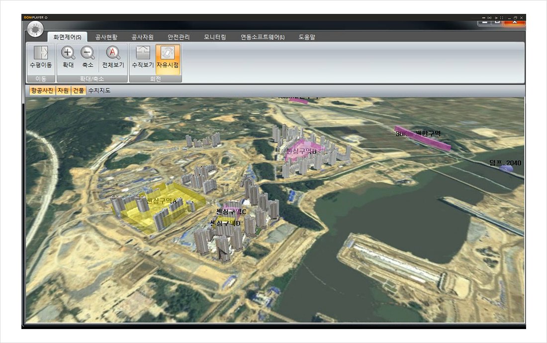
Integrated Monitoring System of Position Recognition Technology for Construction Site
| Orderer |
|
|---|---|
| Dev’t Overview |
|
| Operation Concept |
|
| System Composition |
|
| Target Performance & Test Result |
|
| Major Technology |
|