
Products & Services

Products & Services
Major Tech
Research & Development Performances
- Integrated Processing System of GEOINT Data
- Establishment of Multi-Image-Based Precision Positioning Data and Production of Application System
- Integrated Monitoring System of Position Recognition Technology for Construction Site
- Development of Intelligent CCTV Control System Using Image-Based Positioning Technology
- Integrated Analysis System for Research into Base on Which to Construct Broad Network Monitoring
- Development of 3D Authoring Tool for Localization of 3D S/W
- Generation of Real-Time Digital Maps and Development of Utilization Technology
- Development of Pre-Processing Algorithms for Fusion of Heterogeneous Images
- Development of UAV Operation Management System
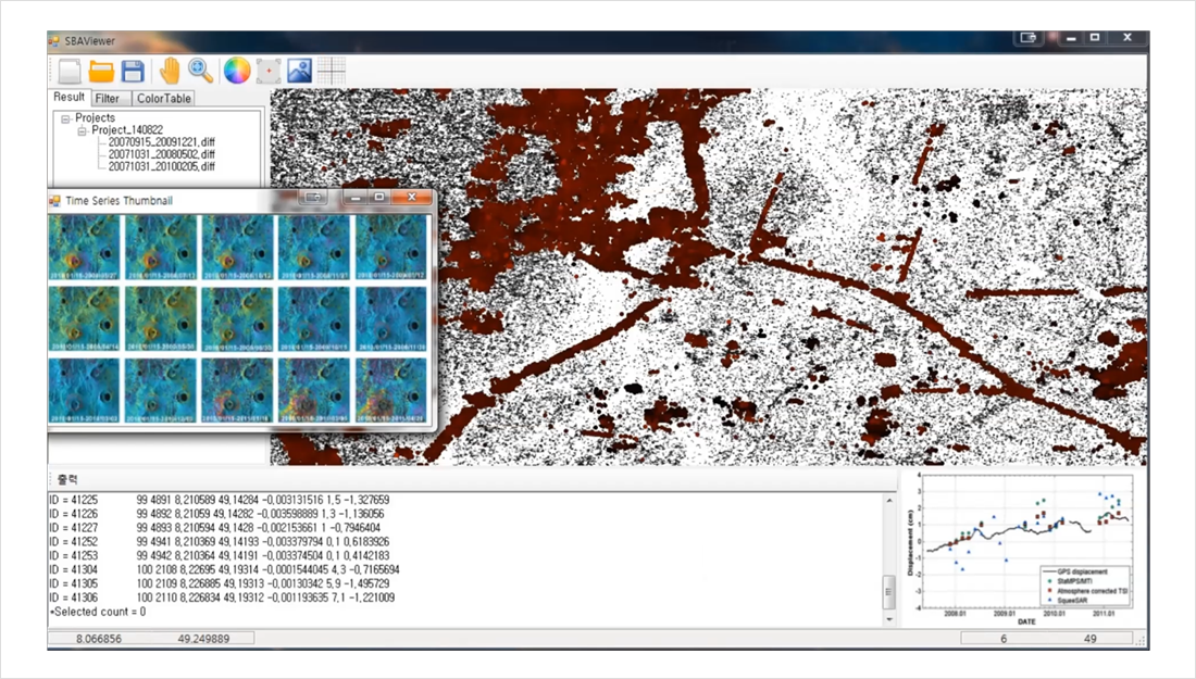
- Construction of Remote Monitoring Technology for Mt. Baekdu Volcanic Terrain by Use of SAR Data
- Development of Software for Inspection of 3D Object Data
- Development of Display System for Time-Series Earth Surface Temperature Changes
- Establishment of Device Identification Environment by Use of Image Characteristics
Construction of Remote Monitoring Technology for
Mt. Baekdu Volcanic Terrain by Use of SAR Data
Mt. Baekdu Volcanic Terrain by Use of SAR Data
| Orderer |
|
|---|---|
| Dev’t Overview |
|
| Operation Concept |
|
| System Composition |
|
| Target Performance & Test Result |
|
| Major Technology |
|